|
Emergency weather notice
Dangerous weather conditions expected to
develop early this afternoon
 Send a link to a friend
[NOV. 15, 2005]
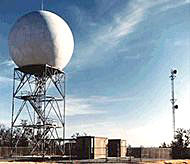
The
National Weather Service in Lincoln issued a hazardous weather outlook
at 10:42 a.m. Tuesday. This hazardous weather outlook is for portions of
central Illinois, east-central Illinois and southeast Illinois: McLean,
Logan, DeWitt, Piatt, Champaign, Vermilion, Menard, Scott, Morgan, Sangamon,
Christian, Macon, Moultrie, Douglas, Coles, Edgar, Shelby, Cumberland,
Clark, Effingham, Jasper, Crawford, Clay, Richland and Lawrence counties.
|
|
Day one: Tuesday and Tuesday night An intensifying area of low
pressure will move to west-central Illinois around the noon hour
today. As the low-pressure area pushes farther into Illinois early
this afternoon there will be an increasing threat for severe
thunderstorms to develop by early afternoon to the east and
southeast of the track of the low. Winds just above the surface will
range from 50 to 60 mph and be quite favorable for the formation of
severe thunderstorms, including tornadoes early this afternoon, with
the primary mode of storms translating into a severe squall line
with widespread wind damage. As it appears now, the highest risk for
tornadoes will occur along and south of a
Bloomington-to-Jacksonville line this afternoon.
Repeating: Fast-moving thunderstorms capable of producing
tornadoes, widespread wind damage and large hail are possible
between noon and 6 o'clock this afternoon and evening.
[to top of second
column in this article] |
This has the potential to be a significant severe weather
outbreak. Residents are urged to be prepared for severe weather this
afternoon and to continue to monitor weather information for the
area through the early evening.
Once the storm system shifts to the north this evening, strong
west to northwest winds, gusting up to 40 mph at times, will usher
in the coldest air of the season so far this fall.
Days two through seven: Wednesday through Monday
The coldest air of the fall season will settle into the Midwest
for the remainder of the period, with little in the way of
significant precipitation expected.
Spotter information statement: Spotter activation will be
necessary today, primarily from noon to 6 p.m.
[News release] |