|
Severe
weather possible late today and this evening
 Send a link to a friend
[April 27, 2009]
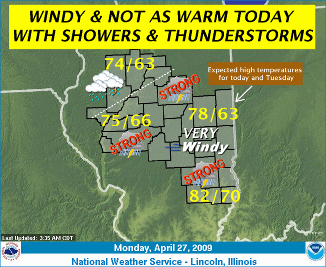
A cold front will track slowly
toward central Illinois today, bringing showers and thunderstorms to
the area. Some of the thunderstorms this afternoon and early this
evening may become severe south of line from El Paso to Rushville.
The primary threat from the thunderstorms will be from damaging
straight-line winds.
|
|
In addition to the thunderstorms, gusty south winds will once again
dominate the weather scene, especially across east-central and
southeast Illinois, where a wind advisory is in effect. In the
advisory area, roughly east of a line from Mahomet to Shelbyville,
winds will be from the south at 25 to 35 mph, with occasional gusts
as high as 45 mph. Showers and thunderstorms will continue this
evening, with rain chances gradually ending from west to east by
Tuesday morning. Only the Interstate 70 corridor will see lingering
shower activity early Tuesday.
Temperatures the next couple of days will cool down closer to
normal as a weak Canadian high pressure drifts across the Great
Lakes.
[Graphic and text from file received from
Terry Storer, Logan County Emergency Management Agency] |

 |