|
Return of warming temps and humidity brings potential for severe
weather this afternoon and evening
 Send a link to a friend
[March 27, 2012]
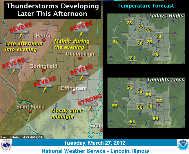
A cold front will move into the area
from the west this afternoon (Tuesday). This front will interact
with a very warm and somewhat humid air mass, producing
thunderstorms along and just ahead of the front. There is a slight
risk that some of the storms could produce severe weather beginning
late this afternoon in the west and extending through the remainder
of the area for this evening and overnight in the southeast. The
primary severe weather threat is large hail and damaging winds;
however, a brief tornado cannot be ruled out late this afternoon as
the storms are developing. In addition, the gusty southerly winds
will bring the return of unseasonably warm air to the region for
today and Wednesday.
|