|
Heavy rain, potentially severe weather forecast through Thursday
 Send a link to a friend
[April 16, 2013]
The
Lincoln office of the National Weather Service posted the weather
graphic below for Tuesday:
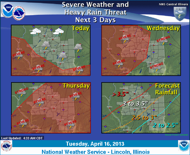
An active weather pattern will be in place for
the next few days, with periods of showers and thunderstorms. As a
frontal boundary lifts northward Tuesday night and Wednesday, warmer
and more unstable air will result in an increasing threat of severe
weather. The severe weather risk will continue into Thursday, before
a cold front pushes through the state Thursday night. Most of
central and southeast Illinois is likely to see a total of 2.5 to
3.5 inches of rain before this system finally exits the area
Thursday night.
For updates, check
http://www.crh.noaa.gov/wxstory.php?site=ilx and http://www.crh.noaa.gov/ilx/.
[From National Weather Service,
Lincoln office] |