|
Severe weather possible tonight into tomorrow; heavy rainfall likely
into Friday
 Send a link to a friend
[April 17, 2013]
The
Lincoln office of the National Weather Service posted the weather
graphic below for Wednesday:
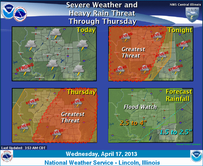
Periods of showers and thunderstorms will
continue through Thursday evening. As a frontal boundary lifts
northward Wednesday, warmer and more unstable air will result in an
increasing threat of severe weather by evening. The greatest risk of
severe weather will be large hail and damaging winds; however, an
isolated tornado is also possible. The severe weather risk will
continue into Thursday, before a cold front pushes through the state
Thursday night. Also, most of central and southeast Illinois is
likely to see an additional of 3 to 4 inches of rain through early
Friday, which is likely to cause areas of flooding on roadways and
rivers. As a result, flash flood watches have been issued for much
of the area.
For updates, check
http://www.crh.noaa.gov/wxstory.php?site=ilx and http://www.crh.noaa.gov/ilx/.
[From National Weather Service,
Lincoln office] |