|
Severe weather threat and heavy rain continue through tonight; low
temps tonight
 Send a link to a friend
[April 18, 2013]
The
Lincoln office of the National Weather Service posted the weather
graphic below for Thursday:
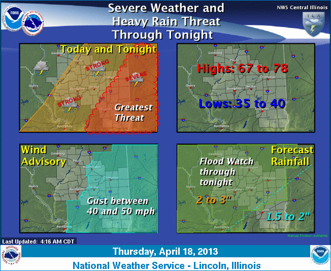
A cold front will begin to sweep through the
area Thursday morning, continuing the strong to severe thunderstorms
across the area through Thursday afternoon and evening. The greatest
risk of severe weather will be in the east and southeastern parts of
the state, with damaging winds and large hail possible. An isolated
tornado is also possible. In addition, heavy rainfall will again be
likely over the area, continuing the flood watch through Thursday
night. In parts of northwestern Illinois, 3 to 5 inches has already
fallen. However, an additional 2 to 3 inches is possible over the
same areas of central and eastern Illinois through tonight, with 1.5
to 2 inches possible in southeast Illinois. Gusty south winds, with
wind gusts of 40 to 50 mph, will also occur in eastern and
southeastern Illinois from Thursday morning through Thursday
afternoon, ahead of the storms.
For updates, check
http://www.crh.noaa.gov/wxstory.php?site=ilx and http://www.crh.noaa.gov/ilx/.
[From National Weather Service,
Lincoln office] |