|
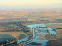
The EF3 tornado that crossed
Logan County on Aug. 19 was on the ground the entire width of
the county, amazingly missing major population areas, but it still
damaged 20-some farmsteads and displaced many families from their
homes, some permanently. Much cleanup work was done in the early
days as friends and neighbors came to help, but much still
remains. At left, 10 1/2 weeks after the tornado, the
same area east of Elkhart is flooded.
Here are some additional
photos of the track left by the destructive force. They were taken
from a higher altitude to gain a different perspective. The first
photos to appear in LDN were taken at 1,800 feet MSL, 1,200 feet above
ground. These were taken on Sept. 3 at 3,000 feet MSL. (See first picture pages.)
Aerial
pictures by Jan Youngquist |
|
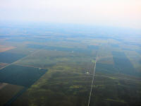
Looking southeast: Just west of Beason, with Chestnut
seen faintly beyond the Salt Creek tree line in the upper left; the
track passes mid-picture from right to left.
|
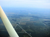
Looking southeast: South of Lincoln along Route 121;
bottom left streets of 1100th St. and 1600th Ave. create a triangle.
The tornado came from the right. White debris remains of a farm are
seen mid-right near 1025th St. |
 |
|
|
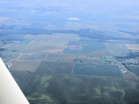
Looking southeast: Route 121 upper left; freight line
between Mount Pulaski and Lincoln on right; 1025th St.
crosses between; tornado path crosses 1025th St. and Route
121. |
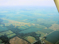
Looking east-southeast: Mount Pulaski in upper right;
tornado path crosses center right to left upward. |
 |
|
|
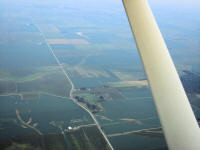
Looking south: To the right is 600th St. and
900 Ave.; tornado path crosses the east-west street of 550th St.
Grain bins under construction were destroyed and debris strewn
through fields to the northeast. |
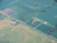
Looking southeast: Tornado crossed just hundreds of
feet in back of tower hill. This is just east of Elkhart; tower
located at 629 1000th St. Oddly enough, sensitive broadcast
equipment on this tower was unaffected. |
 |
|