|

The nation's weather
 Send a link to a friend
[February 01, 2012]
(AP) There are two weather
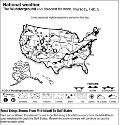
systems that will affect the nation Wednesday. One will be the
Pacific front that will push through the West, and the other one will
be the storm system over the Great Lakes moving through New England.
(Click on
map for larger image.) |
|
 Out West, rain and high-elevation snow will continue from Washington southward to northern California Wednesday morning as the Pacific front approaches. This system is expected to push ashore late Wednesday morning, reaching the
northern Plains by Thursday morning. As a result, rain and mountain snow will gradually expand eastward across the Intermountain West throughout the day. By the evening, the West Coast should dry out as the system moves east and a ridge of high pressure builds from the
eastern Pacific. Out West, rain and high-elevation snow will continue from Washington southward to northern California Wednesday morning as the Pacific front approaches. This system is expected to push ashore late Wednesday morning, reaching the
northern Plains by Thursday morning. As a result, rain and mountain snow will gradually expand eastward across the Intermountain West throughout the day. By the evening, the West Coast should dry out as the system moves east and a ridge of high pressure builds from the
eastern Pacific.
Moving eastward, the storm system over the Great Lakes will continue to advance eastward and carry a cold front through the Ohio Valley and Northeast. Rich Gulf moisture combined with cold air on the surface and warm air aloft will lead to periods of mixed snow, sleet and freezing rain Wednesday morning over parts of central New England. To the south of the warm front, all rain is expected through the rest of New England. In addition, widely scattered showers and thunderstorms will fire up ahead of the cold front across much of the lower Mississippi Valley, Southeast and Mid-Atlantic. In particular, strong thunderstorms with locally heavy rain are possible from the central Gulf Coast northeastward to
southern Appalachians.
Temperatures in the Lower 48 states Tuesday ranged from a morning low of
minus 19 degrees at Clayton Lake, Maine, to a high of 82 degrees at Fort Myers, Fla.
|

