|
 U.S.
scientists to map interior of Mount St. Helens volcano U.S.
scientists to map interior of Mount St. Helens volcano
 Send a link to a friend
[July 24, 2014]
By Victoria Cavaliere
SEATTLE (Reuters) - A series of explosions
set off by a team of scientists were expected to rattle Washington
state's Mount St. Helens on Wednesday as researchers map the interior of
the volcano, whose 1980 eruption was the deadliest in U.S. history.
|
|
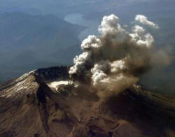
 Mount St. Helens, about 95 miles (150 km) south of Seattle and 50
miles (80 km) north of Portland, erupted in an explosion of hot ash
in May 1980, spewing debris over a wide area, killing 57 people and
causing more than a billion dollars in damage. Mount St. Helens, about 95 miles (150 km) south of Seattle and 50
miles (80 km) north of Portland, erupted in an explosion of hot ash
in May 1980, spewing debris over a wide area, killing 57 people and
causing more than a billion dollars in damage.
Scientists from across the United States are trying to get a better
handle on the magma stores and internal workings of the 8,300-foot
(2,530-meter) volcano to improve warning systems prior to eruption.
"Mount St. Helens and other volcanoes in the Cascade Range threaten
urban centers from Vancouver to Portland," lead scientist Alan
Levander of Rice University in Houston said in a statement.
"We'd like to better understand their inner workings in order to
better predict when they may erupt and how severe those eruptions
are likely to be," he said.

On Wednesday, geophysicists from across the United States were to
begin running seismic waves through the volcano's interior by firing
"shots" at the mountain to install mapping instruments deep
underground.
The instruments will help create a sort of CAT scan on the interior
and will "illuminate the architecture of the greater Mount St.
Helens magmatic system from slab to surface," according to
researchers from the project, called Imaging Magma Under St. Helens,
or iMUSH (http://imush.org/)
A total of 23 boreholes 80 feet (24 meters) deep were to be
installed by July 31, said researcher Steve Malone.
[to top of second column] |

"These shots are done at night to give the best chance of recording
good signals without other vibrations being present such as from
wind or vehicle traffic," Malone said.
Residents living near Mount St. Helens were unlikely to feel the
shots because of their depth, but their insertion approximates a
magnitude 2 earthquake, scientists said.
In May, the U.S. Geological Survey said that magma levels were
slowly rebuilding inside Mount St. Helens, but there was no sign of
an impending eruption.
(Reporting by Victoria Cavaliere; Editing by Cynthia Johnston and
Sandra Maler)
[© 2014 Thomson Reuters. All rights
reserved.] Copyright 2014 Reuters. All rights reserved. This material may not be published,
broadcast, rewritten or redistributed.
 |