|
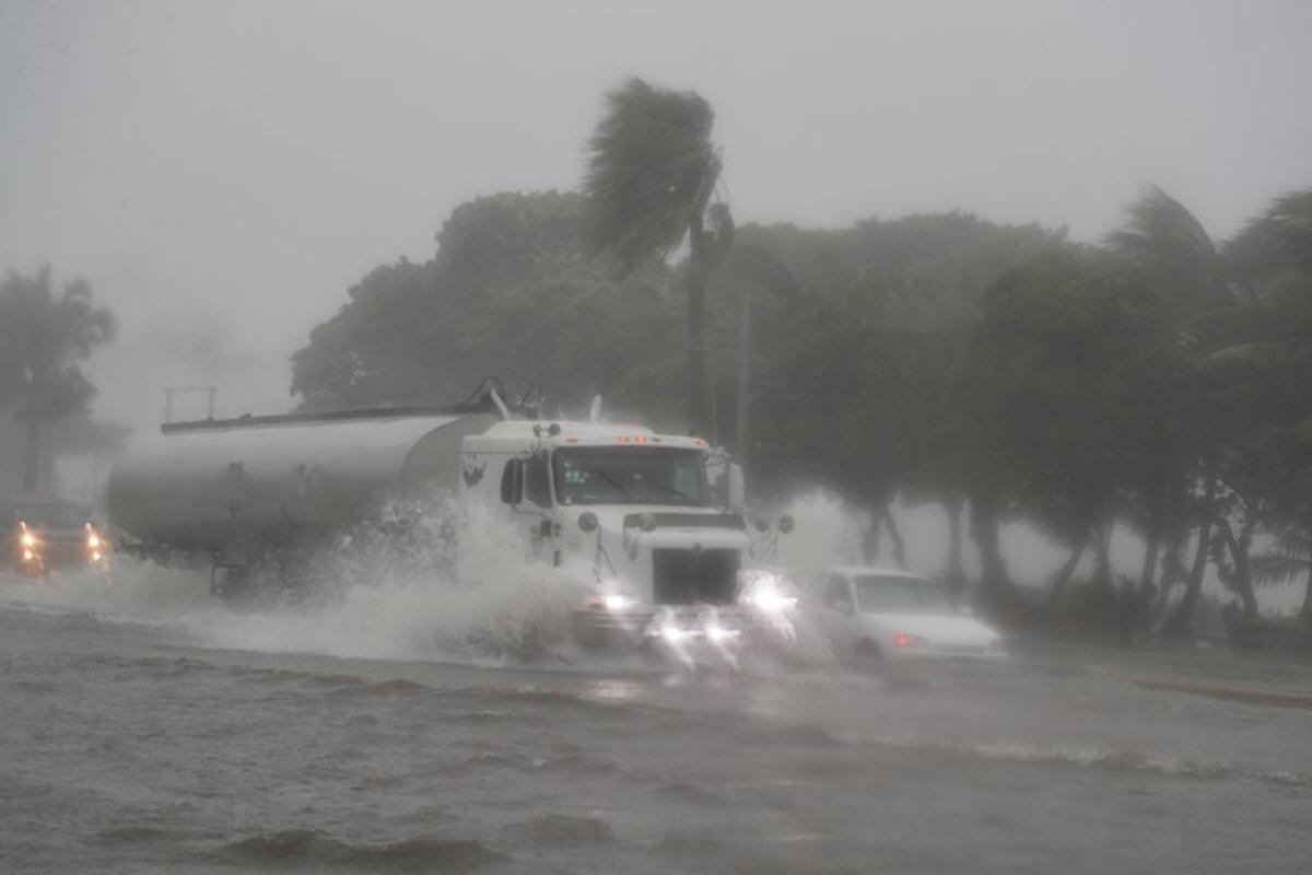
The
powerful storm struck the coast at 3:15 p.m. EST, about 25 miles
west of Apalachicola, close to the city of Port St. Joe, home to
some 3,500 residents, said Andrew Hagen, marine forecaster at
the Miami-based National Hurricane Center (NHC).
Before hitting the coast, the storm battered the Florida barrier
island of Cape San Blas, Hagen said.
"With a tropical storm, you're going to have similar impacts
spread out across much of the Florida Panhandle, really from
Apalachicola all the way to Tallahassee. A lot of those areas
are going to be experiencing similar winds and similar rain.
It's not like it's a lot worse at the landfall point," Hagen
said.
Now that the storm has made landfall, it was expected to begin
weakening, Hagen said.
"We do expect it to weaken fairly quickly as the late afternoon
and evening progresses and it moves inland," Hagen said.
"We do think we could get storm surge as much as 5 feet (1.5
meters) above ground level, so if you were to stay in those
areas, it would be very dangerous," said Robbie Berg, hurricane
specialist at NHC.
Additionally, heavy rainfall of up to 12 inches (30 cm) in some
isolated spots in Florida was forecast, as well as drenching
downpours in southeastern Alabama, Georgia and the western
Carolinas, said senior hurricane specialist Richard Tasch.
Several school districts in western Florida closed for the day,
promising to reopen on Tuesday.
“Buses cannot safely transport students at winds greater than 35
mph and current information indicates that we may experience 35
mph wind gusts beginning around 1 p.m.,” the Santa Rosa County
school district said on its website.
(Reporting by Barbara Goldberg in New York; editing by Jonathan
Oatis and Cynthia Osterman)
[© 2021 Thomson Reuters. All rights
reserved.] Copyright 2021 Reuters. All rights reserved. This material may not be published,
broadcast, rewritten or redistributed.
Thompson Reuters is solely responsible for this content.

|
|