Storm packing heavy ice, snow bears down on large swath of U.S
 Send a link to a friend
 [February 02, 2022]
(Reuters) - A major winter storm is
expected to wallop much of the central United States and stretch to
parts of the Northeast this week, bringing heaving snow, freezing rain,
and ice, the National Weather Service (NWS) said. [February 02, 2022]
(Reuters) - A major winter storm is
expected to wallop much of the central United States and stretch to
parts of the Northeast this week, bringing heaving snow, freezing rain,
and ice, the National Weather Service (NWS) said.
The system, which is set to begin Tuesday night and last through
Thursday, could dump 6 to 12 inches (15 to 30 cm) of snow over portions
of the southern Rockies and central Plains, with record snowfall
possible in the Midwest as well.
"While typical in terms of the time of year that you might expect
something like this, potentially atypical in terms of some of the
snowfall amounts we may see in parts of the Midwest," said Greg Carbin,
the forecast operations branch chief for the NWS Weather Prediction
Center.
Snow could blanket Detroit in amounts not seen in years, Carbin added,
while icy roads and bridges threatened to make travel "nearly
impossible." Power outages are also possible.

A "corridor of heavy ice accumulation" will stretch from the Ohio River
Valley down to Texas, according to the forecast.
Winter weather advisories, storm watches and warnings are in effect in
many of the areas in the storm's path.
[to top of second column]

|

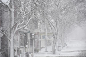
A view of buildings and a street covered in snow in Nantucket,
Massachusetts, U.S. January 29, 2022 in this picture obtained from
social media. Picture taken January 29, 2022. Chad Pierre
Photography/via REUTERS
 In Texas, where a deadly deep freeze
last year crippled the state's electric grid, leaving millions
without power in freezing temperatures, Governor Greg Abbott sought
to reassure residents on Tuesday, saying the grid was prepared.
"We're all mindful of what happened last February in Texas," said
Carbin, the NWS meteorologist. "The event coming up is going to
introduce a shot of cold air and it's a mixed winter precipitation
at this time, it looks nothing like what we saw last February in
terms of both intensity and duration."
Extremely cold air caused by Arctic high pressure that is forecast
to descend over the Plains on Wednesday will send temperatures
plummeting 10 to 15 degrees below average in some areas, the NWS
added.
The storm threat comes days after fierce winter weather engulfed the
northeastern part of the United States, dropping more than 2 feet
(60 cm) of snow on some areas and packing high winds, prompting
thousands of flight cancellations and curtailing access to the roads
in some states.
(Reporting by Maria Caspani in New York; additional reporting by
Khaniska Singh in Bengaluru; Editing by Matthew Lewis and Rosalba
O'Brien)
[© 2022 Thomson Reuters. All rights
reserved.] This material may not be published,
broadcast, rewritten or redistributed.
Thompson Reuters is solely responsible for this content. |