|
Low-flying helicopter will survey
Illinois River Basin for geologic, water studies
Expect to see this odd sight throughout
Central Illinois
 Send a link to a friend
 [January 20, 2023] [January 20, 2023]
Starting on or around January 24 and lasting
three to four weeks, a helicopter towing a large hoop from a cable
will begin making low-level flights over the Illinois River Basin,
covering much of central Illinois and parts of northwest Indiana.
Geophysical measurements will be collected by the helicopter as part
of the U.S. Geological Survey Next Generation Water Observing System
(NGWOS) project to support studies of groundwater in the Illinois
River Basin. This study expands on similar work done last year in
the upper part of the Basin around southeastern Wisconsin.
The helicopter will fly along pre-planned flight paths relatively
low to the ground, hundreds of feet above the surface. A sensor that
resembles a large hula-hoop will be towed beneath to measure tiny
electromagnetic signals that can be used to map features below
Earth’s surface. Most survey flight lines will be separated by about
12 miles, so the helicopter system will only be visible from any
particular location for a short period of time.
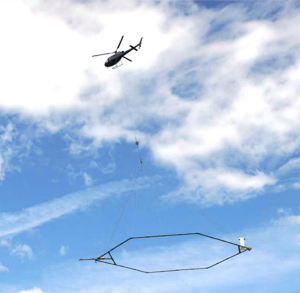
The survey will be conducted by SkyTEM, a specialty
airborne geophysical company, through a USGS contract with Woolpert.
[to top of second column] |

The helicopter will be operated by experienced pilots
from LiveWire Aviation who are specially trained for the low-level
flying required for geophysical surveys.
The company works with the FAA to ensure flights are
safe and in accordance with U.S. law.
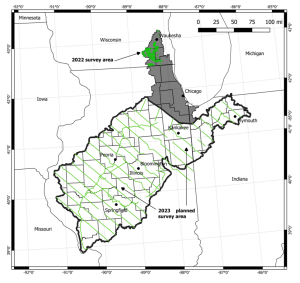
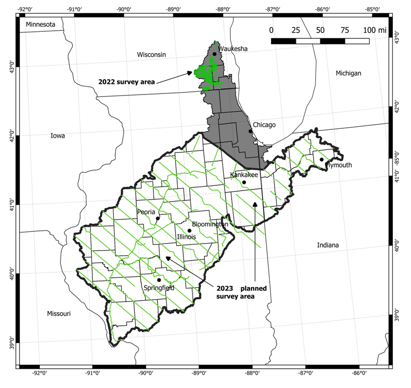
This map shows the airborne geophysical survey area
and planned flight paths across the Illinois River Basin in Illinois
and northwest Indiana. Surveys will not occur directly above
populated areas. Planned flight lines and survey progress can be
found
online.
[Heidi Koontz
Public Affairs Specialist]
 |