Stronger, bigger Hurricane Erin forecast to create dangerous surf along
US coast
[August 18, 2025]
MIAMI (AP) — A stronger and bigger Hurricane Erin pelted parts of the
Caribbean and was forecast to create dangerous surf and rip currents
along the U.S. East Coast this week.
It reintensified to a Category 4 storm with 130 mph (215 kph) maximum
sustained winds early Monday and moved closer to the Southeast Bahamas,
according to the U.S. National Hurricane Center in Miami.
Around 5 a.m. Monday, Erin was about 105 miles (170 kilometers)
north-northeast of Grand Turk Island and about 915 miles (1,470
kilometers) south-southeast of Cape Hatteras, North Carolina. The storm
was moving northwest at 13 mph (20 kph).
The Bahamas government issued a Tropical Storm Watch for the central
Bahamas, while a Tropical Storm Warning remained in effect for the Turks
and Caicos Islands and southeast Bahamas, the hurricane center reported.
Additional strengthening was forecast for Monday followed by gradual
weakening, but Erin was expected to remain a large, major hurricane into
midweek.
Hurricane-force winds extended up to 60 miles (95 kilometers) from the
center and tropical-storm-force winds extend outward up to 230 miles
(370 km). The area of strong winds is expected to grow more over the
next few days. At that size, Erin will impact coastal areas even though
it isn't forecast to make a direct landfall.

Dare County, North Carolina, declared an emergency and ordered an
evacuation beginning Monday of Hatteras Island on the Outer Banks, the
thin stretch of low-lying barrier islands that juts far into the
Atlantic. Several days of heavy surf and high winds and waves could wash
out parts of N.C. Highway 12 running along the barrier islands, the
National Weather Service said.
Erin, the year's first Atlantic hurricane, reached an exceedingly
dangerous Category 5 status Saturday with 160 mph (260 kph) winds before
weakening.
[to top of second column]
|

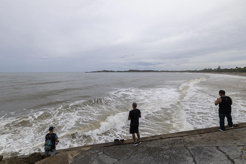
People fish along the shore in Arecibo, Puerto Rico, as Hurricane
Erin brings rains to the island, Sunday, Aug. 17, 2025. (AP
Photo/Alejandro Granadillo)

“You’re dealing with a major hurricane. The intensity is
fluctuating. It’s a dangerous hurricane in any event,” Richard Pasch
of the National Hurricane Center said.
Erin’s outer bands pelted parts of Puerto Rico and the Virgin
Islands with heavy rains and tropical-storm winds during the day
Sunday.
That knocked out power to about 147,000 customers, according to Luma
Energy, a private company that oversees the transmission and
distribution of power on the island. More than 20 flights were
canceled due to the weather. The Coast Guard allowed all ports in
Puerto Rico and the U.S. Virgin Islands to reopen Sunday as winds
and rains decreased.
Rough ocean conditions were forecast for parts of the Virgin
Islands, Puerto Rico, Hispaniola and the Turks and Caicos.
Life-threatening surf and rip currents were forecast into midweek
for the Bahamas, Bermuda, the U.S. East Coast and Canada's Atlantic
coast as Erin turns north and then northeast.
Scientists have linked the rapid intensification of hurricanes in
the Atlantic to climate change. Global warming is causing the
atmosphere to hold more water vapor and is spiking ocean
temperatures, and warmer waters give hurricanes fuel to unleash more
rain and strengthen more quickly.
All contents © copyright 2025 Associated Press. All rights reserved
 |