Military jamming disrupted a medical plane's GPS system before it
crashed last month in New Mexico
[June 19, 2026]
By JOSH FUNK
The GPS system on a small medical plane that crashed into a mountainside
last month in New Mexico malfunctioned because the military was jamming
that signal throughout the area at the time although pilots had been
warned to expect that, according to federal investigators.
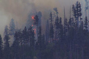
Four people died in the pre-dawn crash on May 14 that sparked a wildfire
that burned for weeks in the rugged Capitan Mountains around Ruidoso
where the plane was trying to land that night.
The National Transportation Safety Board released a preliminary report
on the crash Wednesday that described the GPS problems the pilots
encountered, but investigators won't identify the cause of the crash
until they finish their final report sometime next year.
Experts say the pilots should have been able to land safely by relying
on ground-based navigation systems or flying visually, but relying on
GPS is popular because it is so precise.
“The loss of GPS should not result in the loss of an airplane, so
there’s got to be more to it than that,” said retired airline pilot John
Cox, who is now CEO of Safety Operating Systems.
The NTSB said that after the pilots of the plane operated by Trans Aero
MedEvac started having problems, the air traffic controller gave them
headings to follow into the airport so they could get lined up for an
approach relying on the airport's instrument landing system. Three other
planes in the area also reported GPS problems around the same time.
The warning the Federal Aviation Administration sent out to pilots
beforehand made reference to the Army's White Sands Missile Range, which
is about 40 miles (65 kilometers) from Ruidoso. The Army did not
immediately respond Thursday to questions from The Associated Press.
At one point, the controller even contacted the military and got it to
shut down the jammers. But then shortly before the crash, the pilots
told controllers they had the airport in sight and planned to land
visually, so controllers gave the military the OK to resume jamming.
“If you can see the runway, you can see the mountain. Why would you fly
into it?” Cox asked, because even with the new details in this
preliminary report, there are still many unanswered questions about the
crash.

Ruidoso, a mountain town with a year-round population of less than
8,000, sits at the base of south-central New Mexico’s Sierra Blanca
range. The surrounding area, which includes Lincoln National Forest, is
heavily forested and rural. The wildfire that started after the crash
burned 49.8 square miles (128.9 square kilometers). Forest Service
officials said the fire was 100% contained on June 12, but it has not
been declared totally out. No structures were damaged in the fire.
[to top of second column]
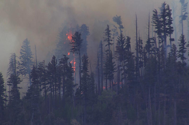
|
Smoke rises from a fire after a small medical plane crashed in
a mountain range outside Ruidoso, N.M., on May 14, 2026. (KOAT via
AP, File)

The FAA published a Notice to Airmen ahead of time warning any
pilots flying into the area that the military would be jamming GPS
signals, so aviation safety expert Steve Arroyo said the medevac
pilots should have been prepared to rely on other navigation
systems.
But Arroyo said pilots often rely on GPS because it can safely guide
them even in challenging territory where there is a narrow margin
for error while navigating around obstacles.
“GPS can bring you in precisely with a margin of safety that’s
required and bring you down for landing. But if you don’t have GPS,
you can’t make that approach within those margins and you may drift
outside using conventional navigation,” said Arroyo, who was a
longtime pilot for United Airlines.

But when the pilots decided to attempt a visual approach they were
taking responsibility to avoid any obstacles on their way into the
airport.
The NTSB said the airplane descended to 9,400 feet (2,865 meters) as
it approached the airport before climbing several hundred feet. But
then the plane struck a mountainside at 9,950 feet (3,000 meters).
The point of impact was about 230 feet (70 meters) below the Capitan
Mountains Summit Radio Facility.
Trans Aero MedEvac has operated in southeastern New Mexico and west
Texas since 1966. The victims who died in the crash were identified
as pilots Keelan Clark and Ali Kawsara with the company Generation
Jets and flight nurses Jamie Novick and Sarah Clark with Trans Aero
MedEvac. The plane was en route from Roswell Air Center to Sierra
Blanca Regional Airport when it crashed.
___
Associated Press writer Jessica Hill contributed to this report from
Las Vegas.
All contents © copyright 2026 Associated Press. All rights reserved |