Hail the size of golf balls pummels parts of Arizona as rare storm moves
through the West
[October 22, 2026]
By WUFEI YU and JESSICA HILL
PHOENIX
(AP) — Hail the size of golf balls and damaging wind gusts pounded
northern and central Arizona in a rare storm blowing through, bringing
with it tornado risks and possible flash floods.
The National Weather Service issued multiple warnings as severe
thunderstorms moved through the state overnight Tuesday and into
Wednesday, encouraging people to seek shelter and stay away from windows
as damaging 2- to 3-inch (5- 7.6-centimeter) hail struck the area. Hail
pummeled people's roofs, shattered windows and dented cars. |
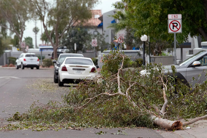
Tree debris obstructs part of a street as storms caused damage at a
local apartment complex, Wednesday, Oct. 21, 2026, in Mesa, Ariz. (AP
Photo/Ross D. Franklin) |
|
Tornado watches were issued for multiple areas — the first the
state has seen since October 2010.
Warm, moist air moving north fuels storms coming off the
California coast. Changing winds can make them spin, creating
the conditions for tornadoes, said Ryan Bernhart, a National
Weather Service meteorologist in Flagstaff.
“This is very unusual for this area at this time of the year,”
Bernhart said.
Strong winds toppled trees in Flagstaff and Mesa, with some
landing on walls and carports. A few dozen ponderosa pines over
30 feet (9 meters) tall fell down in the Coconino National
Forest, northwest of Flagstaff.
“These are not small trees that are down," Bernhart said. “These
are pretty strong trees that had been knocked down.”
The greatest threat to the Phoenix metro area is heavy rainfall
and flash flooding tonight and Thursday morning, said Mark
O’Malley, a meteorologist at the National Weather Service office
in Phoenix.
___
Jessica Hill reported from Las Vegas.
All contents © copyright 2026 Associated Press. All rights
reserved |
|
|