|
According
to Rod Palmer, warning coordination meteorologist at the
local NWS office, Lincoln's station is one of 120 Doppler
stations throughout the country that provides the most
accurate and up-to-date information for use in short-term
and long-term forecasts.
"The
entire program was a 10-year project that cost $4.5
billion dollars," he said. "Each station has a
range of about 125 miles. The radar beam starts out at
just under 12 inches and widens out. By the time the beam
has reached the 125-mile perimeter, it has spread to about
10,000 feet."

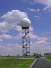
The
Doppler antenna, located under the fiberglass dome that
sits on top of a 100-foot tower, sends out 800
"flashes" per second and receives 800 signals
back in that same second. The information is analyzed, and
forecasts and predictions are based upon
computer-generated schematics.

[Doppler dome]
"Particularly
during this time of year," Palmer said,
"conditions can produce severe thunderstorms that may
in turn spawn tornadoes."
The
information that the Lincoln service provides to its
35-county area gives the earliest possible warning for the
public to seek shelter if such conditions occur.
"Portable
weather radios that have the feature of automatically
sounding a weather warning when the NWS issues one are
extremely beneficial," he said.
Palmer
cited an example when a storm hit at night and, although
ample warning was given, people were asleep and weren't
able to respond quickly enough. A number of fatalities
occurred due to the lack of preparedness.
"Weather
warning radios should be as common in homes as smoke
detectors," Palmer said. "In 'Tornado Alley,'
people need as much warning as necessary," he added.

One
aspect of storms that people overlook is that
straight-line winds traveling in front of a storm can be
as devastating as tornadic winds.
"Winds
pulled into thunderstorms enter on the southwest side and
then rise dramatically and eventually come down as
downdrafts and exit ahead of the storm, with winds that
reach high velocities," Palmer said. "Such winds
are capable of throwing all types of debris at violent
speeds that can crash through windows and penetrate walls.
Any time a warning is issued, individuals must move away
from windows and go to an interior portion of the
house," he added.
(To
top of second column)
|

Areas
in Oklahoma are incorporating a "safe room" in
homes to provide adequate protection from such storms. The
rooms are constructed in such a manner that they would
withstand major damage.
Besides
issuing severe weather warnings, the NWS office provides
ongoing information about winds and conditions at higher
altitudes. The information is used by various airports and
other agencies.

"We
also send hydrogen-filled weather balloons aloft to
determine various atmospheric conditions and then relay
that information so that maps can be made for the use of
pilots," Palmer said. "Such maps," he
added, "are now internationally consistent so that a
pilot can read a map that originated in any country."
A
staff of 23, including 10 meteorologists, a data
acquisition officer, a science officer and others, compile
the information that is gathered and distributed. Help in
gathering information during severe weather episodes is
provided by trained weather observers who relay actual
conditions and movement of these storms, Palmer said.
"We
get calls from contractors and farmers wanting information
on imminent rainfall possibilities with respect to when it
may start and end and where it's going. It can save
contractors money by calling off workers if weather
conditions are going to deteriorate during certain
construction phases," he said. "Owners of
racetracks have also called to see if the weather that
appears menacing is actually going to affect their
operations," Palmer added.

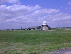
[Lincoln National Weather Station]
Currently,
the interest is on the 90-day outlook and if drought
conditions are going to materialize.
With
the efforts of the Lincoln office and all the other
Doppler stations that collect, analyze and distribute
weather-related information, the NWS can draw a clearer
picture of weather and its impact for use by other
government agencies and the public and private sectors, so
that appropriate steps can be taken in the event a drought
occurs.
We
cannot avoid the weather that comes in all forms, but NSW
offices such as the one in Lincoln compile the most
accurate database so the effects of all types of climatic
conditions can be minimized and dealt with in a safe and
logical manner.
[Fuzz Werth]
|