|
 Atlas shows effects of climate change on Africa Atlas shows effects of climate change on Africa
 Send a link to a friend
[June 11, 2008]
JOHANNESBURG, South Africa (AP) -- The United Nations environment agency unveiled a new atlas Tuesday that shows what the agency says are the dramatic effects of climate change on Africa.
The nearly 400-page publication features over 300 satellite images taken in every African country. The before and after photographs, some of which span a 35-year period, appear to show striking environmental changes across the continent.
|
|
 "The atlas clearly demonstrates the vulnerability of people in the region to forces often outside their control," Achim Steiner, executive director, for the United Nations Environment Program said at a meeting of African environmental ministers in Johannesburg. "It is an indication of how serious the situation has become." "The atlas clearly demonstrates the vulnerability of people in the region to forces often outside their control," Achim Steiner, executive director, for the United Nations Environment Program said at a meeting of African environmental ministers in Johannesburg. "It is an indication of how serious the situation has become."
Although Africa produces only 4 percent of the world's total carbon dioxide emissions, its inhabitants are expected by some officials to suffer most from the consequences of climate change.
"Africa is one of the regions least responsible for climate change, and is also least able to afford the costs of adaptation," said Marthinus Van Schalkwyk, South Africa's minister of environmental affairs and tourism.

According to the atlas, Africa is losing nearly 10 million acres of forest every year
-- twice the world's average deforestation rate. Some areas of the continent are losing over 55.12 tons of soil per 2.5 acres each year, the atlas says.
The atlas also appears to illustrate that erosion as well as chemical and physical damage have degraded about 65 percent of the continent's farmlands. The migration of refugees is causing further pressure on the environment, the atlas says.
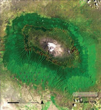
Besides well-publicized changes, such as Mount Kilimanjaro's shrinking glaciers, the drying up of Lake Chad and falling water levels in Lake Victoria, the atlas offers documentation of new or lesser known environmental changes.
These include the disappearance of glaciers in Uganda's Rwenzori Mountains and forests in Madagascar, and the loss of Cape Town's unique
'fynbos' shrubland vegetation.
[to top of second column]
 |
 The atlas shows the swell of gray-colored cities over once-green countryside, the tracks of road networks through forests and the erosion of deltas.
It shows the dramatic expansion of cities such as Senegalese capital Dakar, which has grown over the past 50 years from a small urban center at the tip of the Cap Verde Peninsula to a metropolitan area with 2.5 million people spread over the entire peninsula.
The compilers of atlas say it will be used as tool by policy makers as well as educators.
"The atlas is a way of bringing local information to a global audience," said project director Asbindu Singh. "If one action is taken on the basis of this report, it will be a huge success."

The atlas also highlights some positive signs in protecting the environment and reversing damage.
"There are many places across Africa where people have taken action
-- where there are more trees than 30 years ago, where wetlands have sprung back, and where land degradation has been countered," Steiner said. "These are the beacons we need to follow to ensure the survival of Africa's people and their economically important nature-based assets."
[Associated
Press; By DEVON HAYNIE]
Copyright 2008 The Associated
Press. All rights reserved. This material may not be published,
broadcast, rewritten or redistributed.
 |