|
 The nation's weather The nation's weather
 Send a link to a friend
[February 29, 2012]
(AP) A strong storm in the
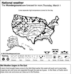
central U.S. will continue moving northeastward through the upper Midwest on Wednesday, bringing heavy snow to areas from the
upper Mississippi Valley through the northern Appalachians. The storm will also bring showers, rain and thunderstorms from parts of the
southern Plains through the eastern valleys and into the Mid-Atlantic.
(Click on
map for larger image.) |
|
 Storms from the
lower and mid-Mississippi valleys through the Mid-Atlantic and coast of the Carolinas may turn severe. Hail, damaging wind and isolated tornadoes are all possible throughout this region. Storms from the
lower and mid-Mississippi valleys through the Mid-Atlantic and coast of the Carolinas may turn severe. Hail, damaging wind and isolated tornadoes are all possible throughout this region.
In the West, another frontal system will move through the northwestern corner of the nation with ample Pacific moisture. This will translate into a significant rain and high-elevation snow event across for parts of the Pacific Northwest, Intermountain West, and northern and central California. Ski areas around Lake Tahoe will see some of their most significant snowfall amounts of the season, with up to 30 inches of snow forecast above 8,000 feet.
Temperatures in the Lower 48 states Tuesday have ranged from a morning low of
minus 13 degrees at Minot AFB, N.D., to a high of 87 degrees at Fort Myers, Fla.
|

